Synopsis: The City of New Bedford, working with the McCabe Enterprises team, engaged residents and stakeholders of the Payne Cutlery neighborhood to develop strategies for reuse of its brownfields.
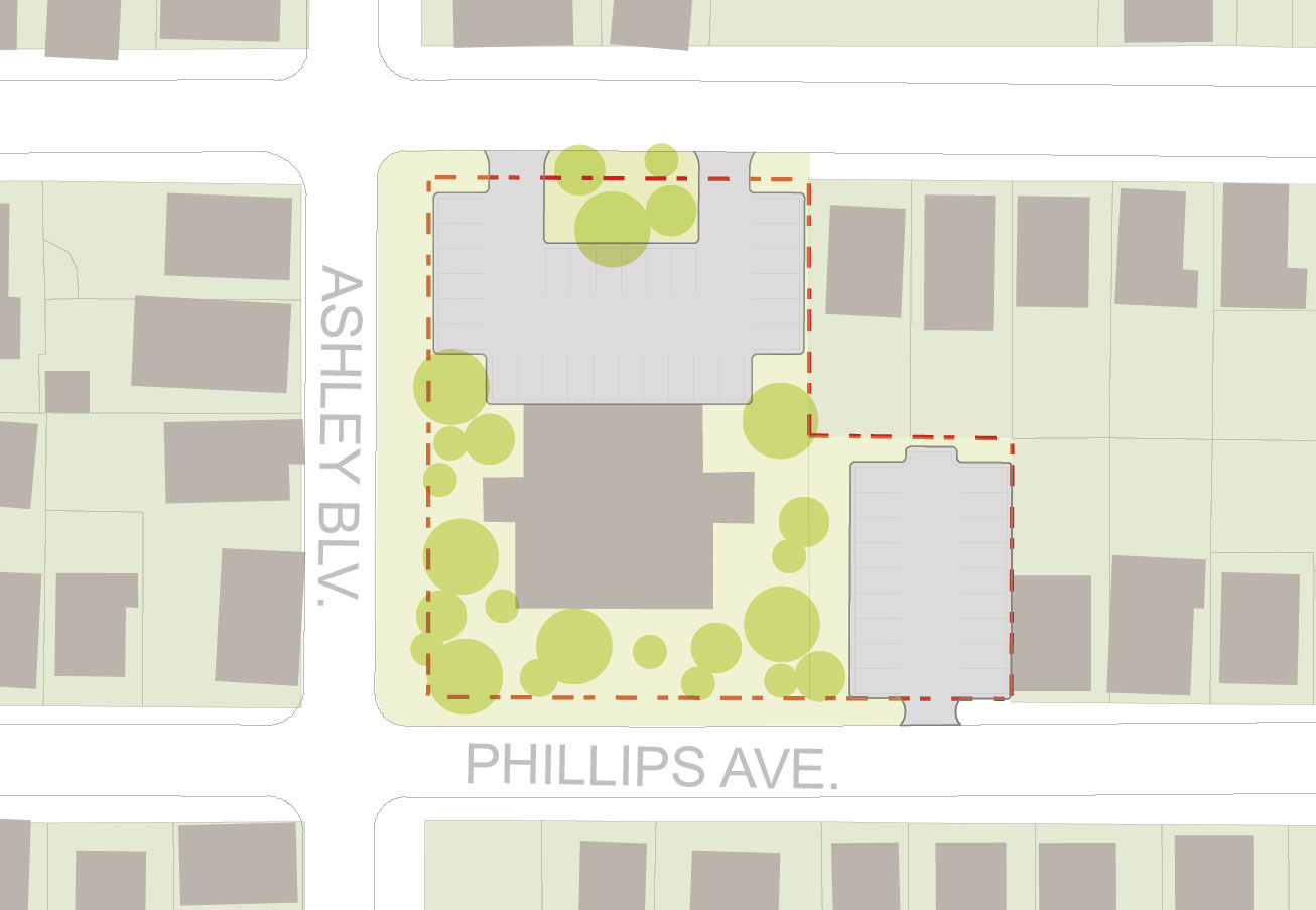
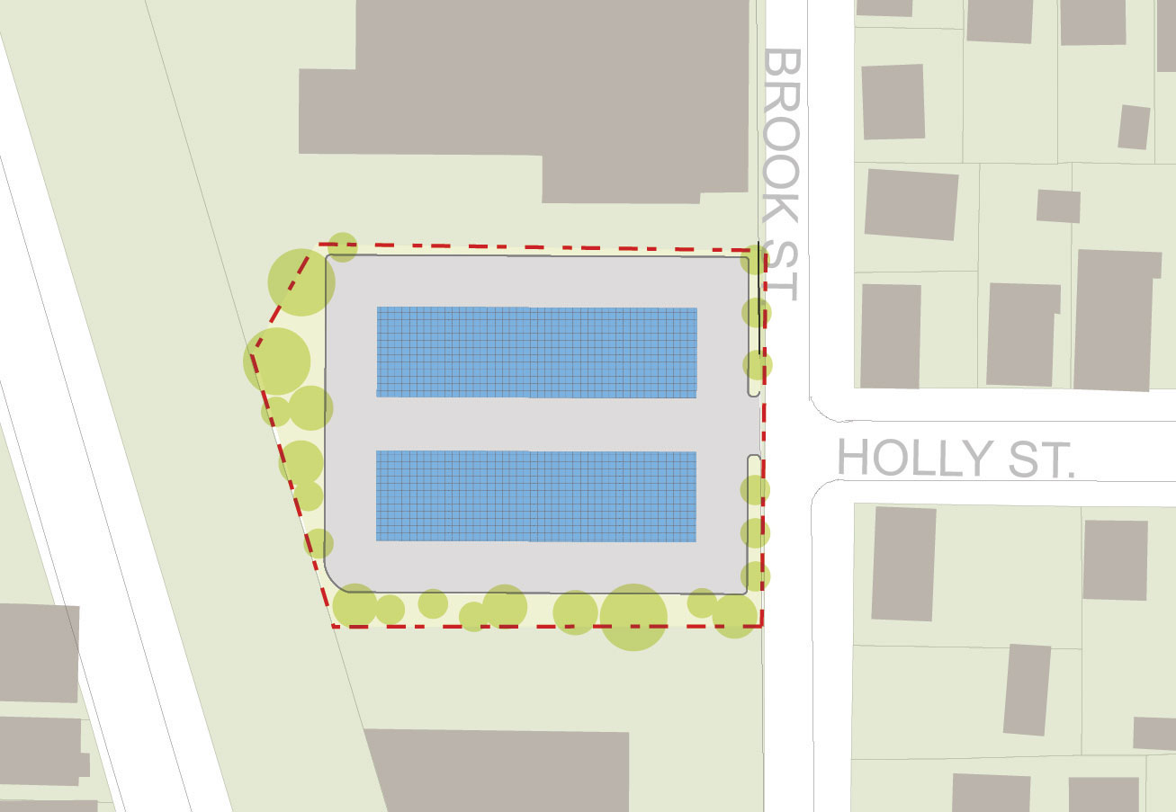
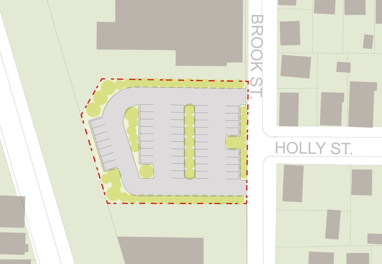
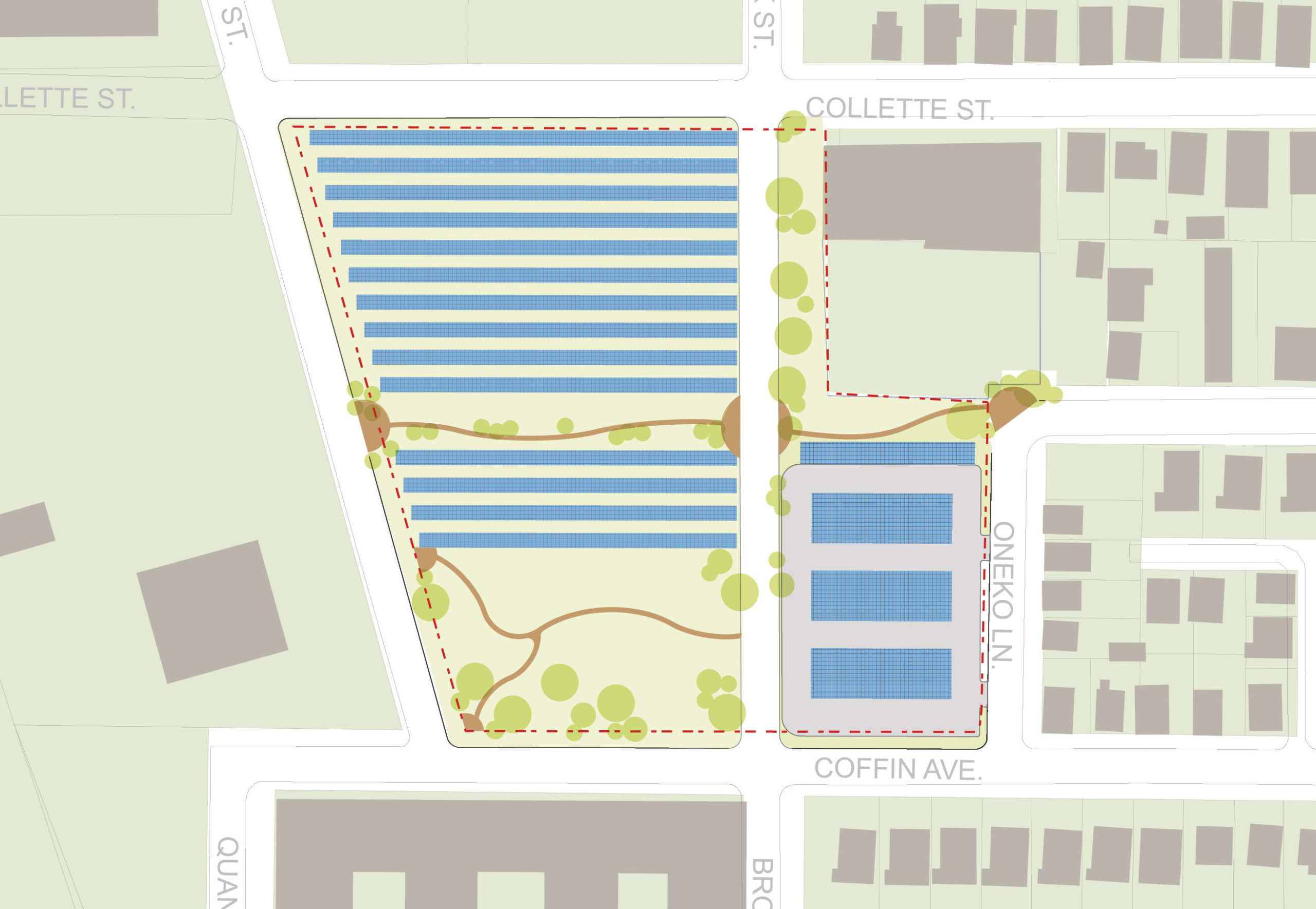
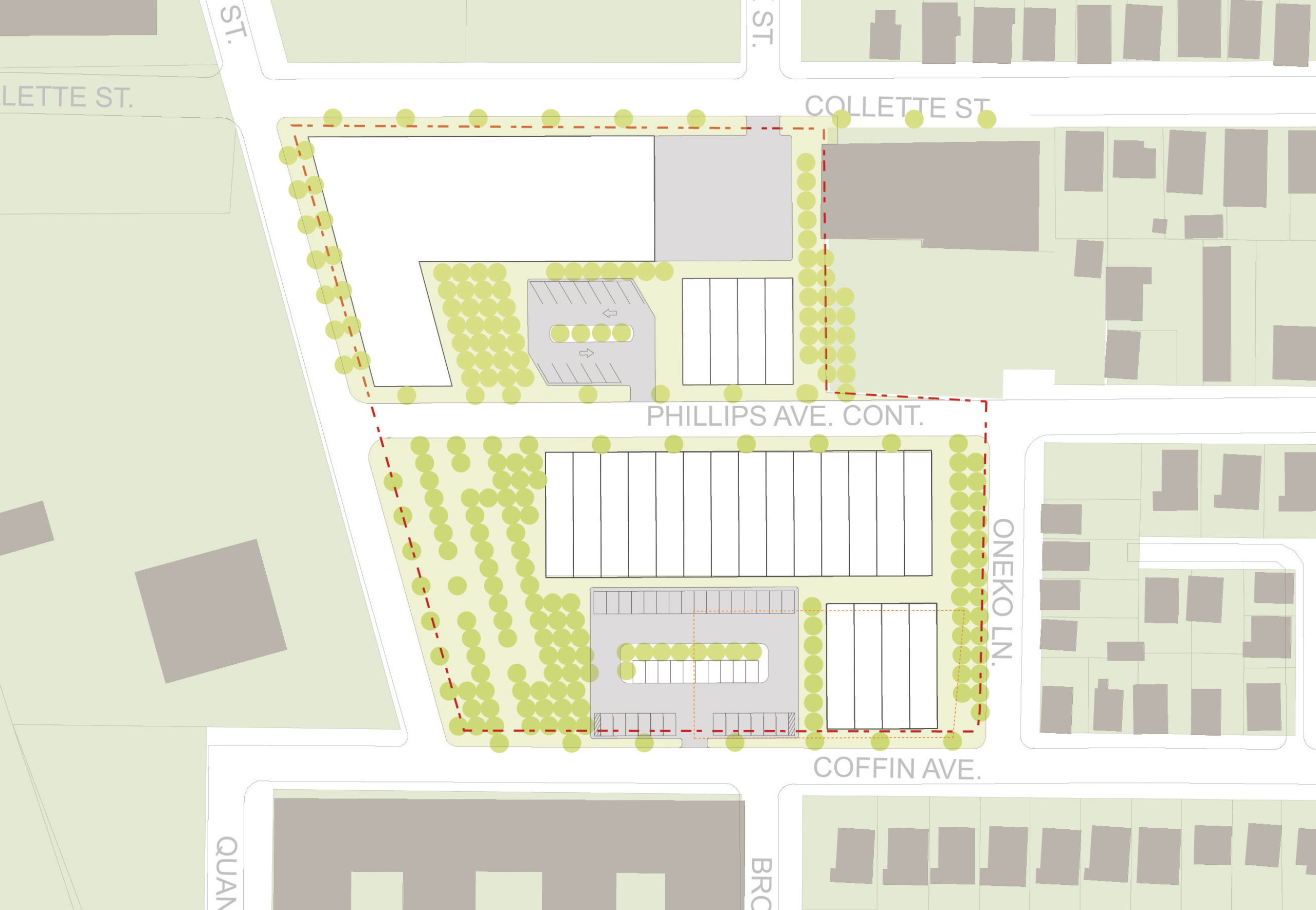
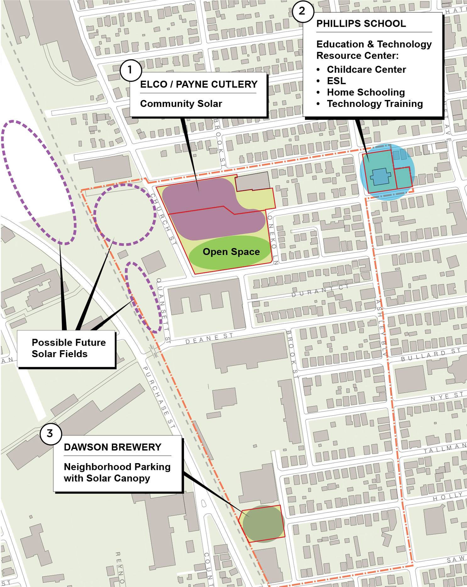
Detailed Description: The City of New Bedford, with support from the Environmental Protection Agency and the Massachusetts Brownfields Task Force, had conducted a brownfields site assessment and cleanup activities, ranging from underground storage tank removal to the reduction of chlorinated volatile organic compounds (VOCs) at the Payne Cutlery site. Now a participatory engagement process involving residents and stakeholders to develop a realistic vision and reuse plan for four city-owned properties was coordinated.
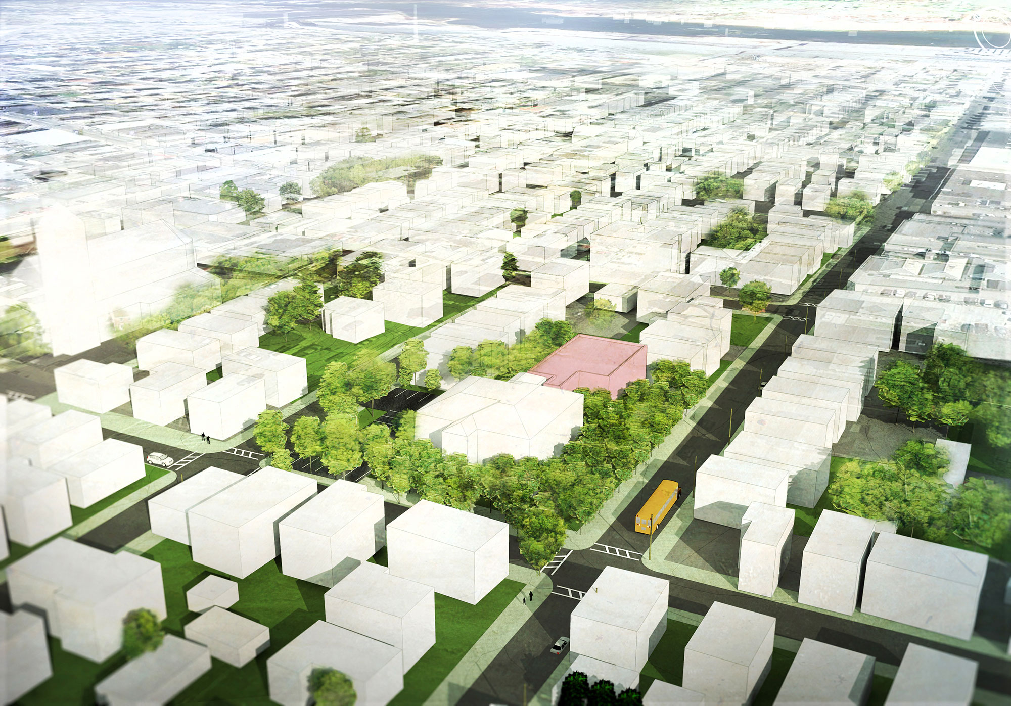
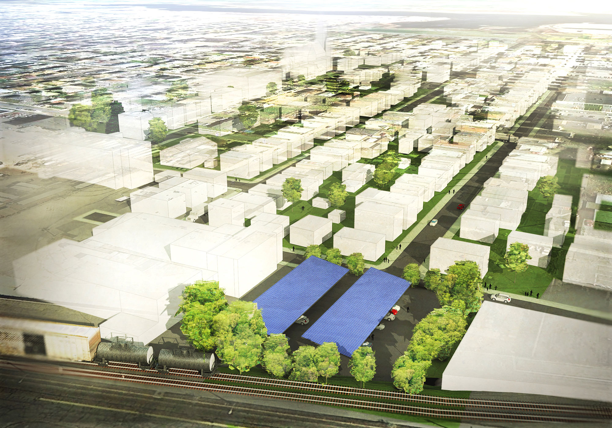
The project area, the fifty-acre Payne Cutlery neighborhood, comprises twelve blocks bounded by the CSX rail line (soon also to be South Coast rail) to the west, Collette Street to the north, Ashley Boulevard (Route 18) to the east, and Sawyer Street to the south in New Bedford’s North End. The mainly residential neighborhood intersperses many three-family buildings with single-family homes, vacant lots, and commercial establishments. It is a gateway neighborhood, one of New Bedford’s poorest, with many new Central American immigrants.
Giant mills and manufacturers once aligned the railroad. Some manufacturing remains along the rail line, but other mills, such as the one at Payne Cutlery and Elco Dress, have been demolished. The neighborhood is strategically located midway between New Bedford’s two South Coast Rail stops: Whale’s Tooth at Pearl and Acushnet and the King’s Highway stop just west of Church Street. Therefore, it has a strong future potential as a thriving midway neighborhood.