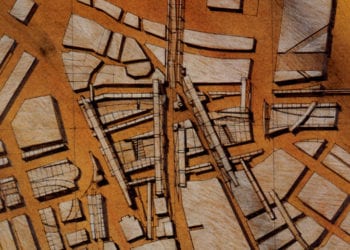
Synopsis: This urban design project digitally reconstructs the history of the North End’s richly layered history both as a didactic tool for community interaction and as a design tool for urban designers and planners. This digital reconstruction includes the massively intrusive construction of the Central Artery Highway project in1955 as well as 300 years of urban transformations pre-dating the Central Artery. Wave after wave of construction, demolition, and re-construction is researched and documented.
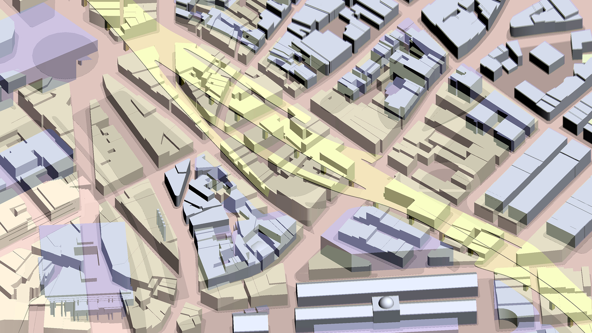
Taken together, this multi-layered digital tool documents street patterns, building types, open spaces, and evolving topographical features. The layers of urban development are super-imposed to create a kind of spatial-temporal collage, so that community members can selectively peel away past layers to see what preceded each historic building and its. This allows a community and its designers to be better informed about what occupied the North End before its current inception, and what might become of the North End in the future, as its future trajectory is considered, designed, and built.
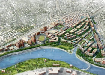
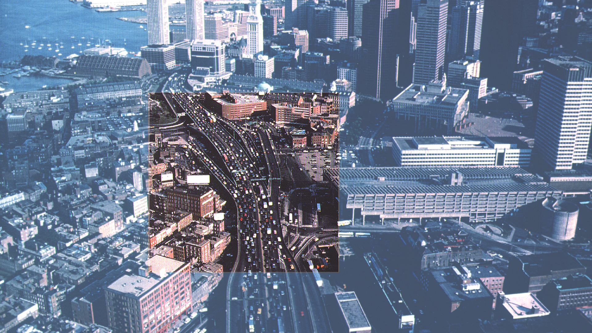
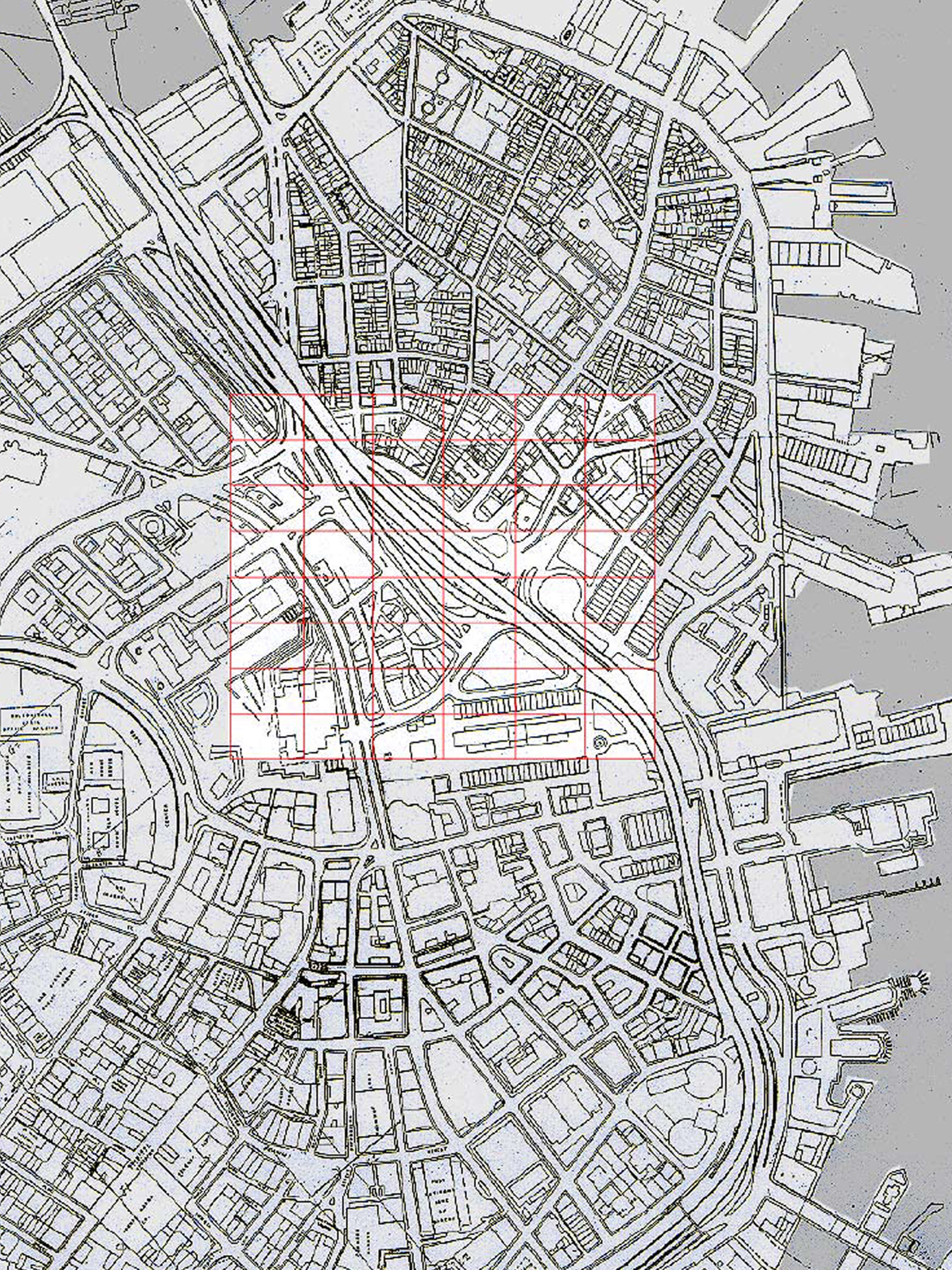
Detailed Description: NEWCAC, a North End community group, asked us to review the Commonwealth’s Central Artery proposals as part of the Mass Move 2000 Review. This process included reviewing the urban design plan for the Boston neighborhoods impacted by the Central Artery’s removal. This elevated highway cut through the heart of Boston’s central and waterfront districts. NEWCAC wanted to influence decisions regarding the fate of new land made available by the Artery’s removal. The area in question was between Dock Square near Faneuil Hall Marketplace and City Hall) and the North End, a vibrant Italian neighborhood.
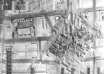
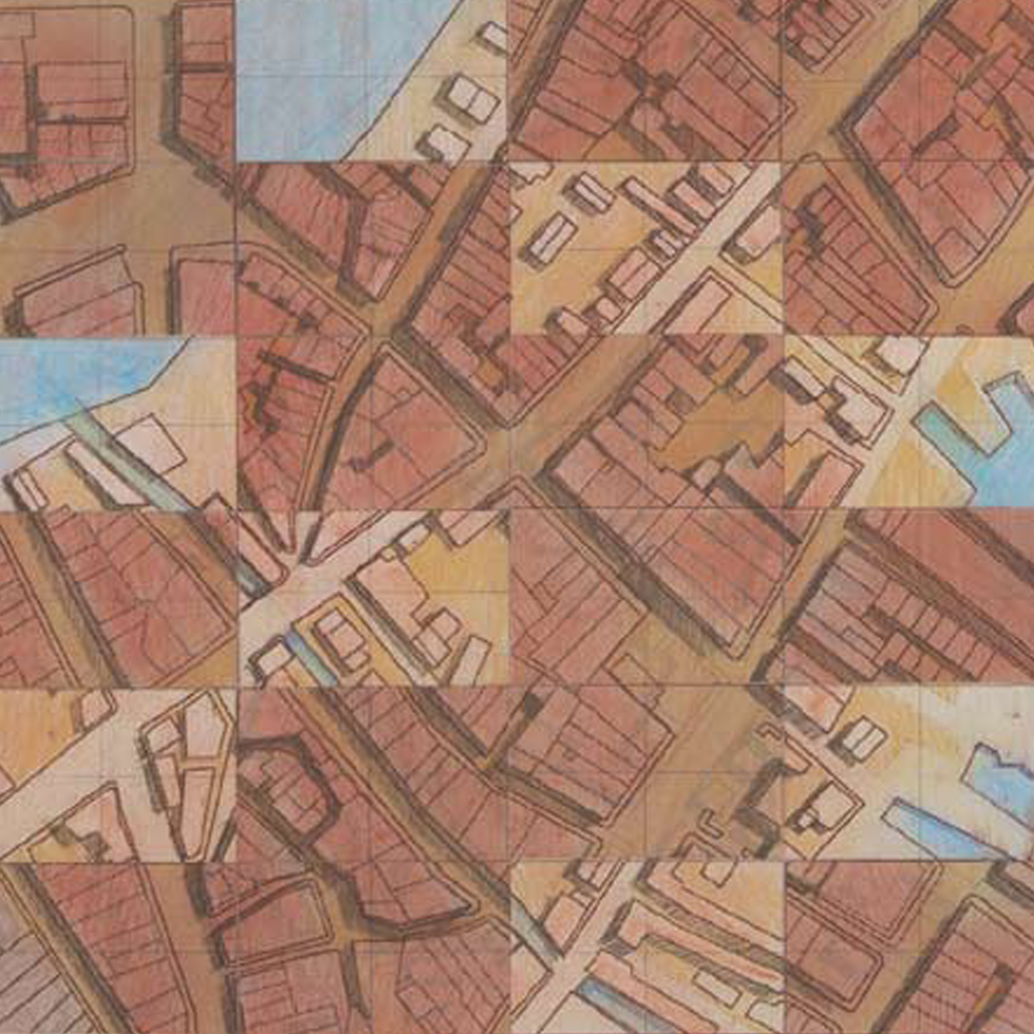
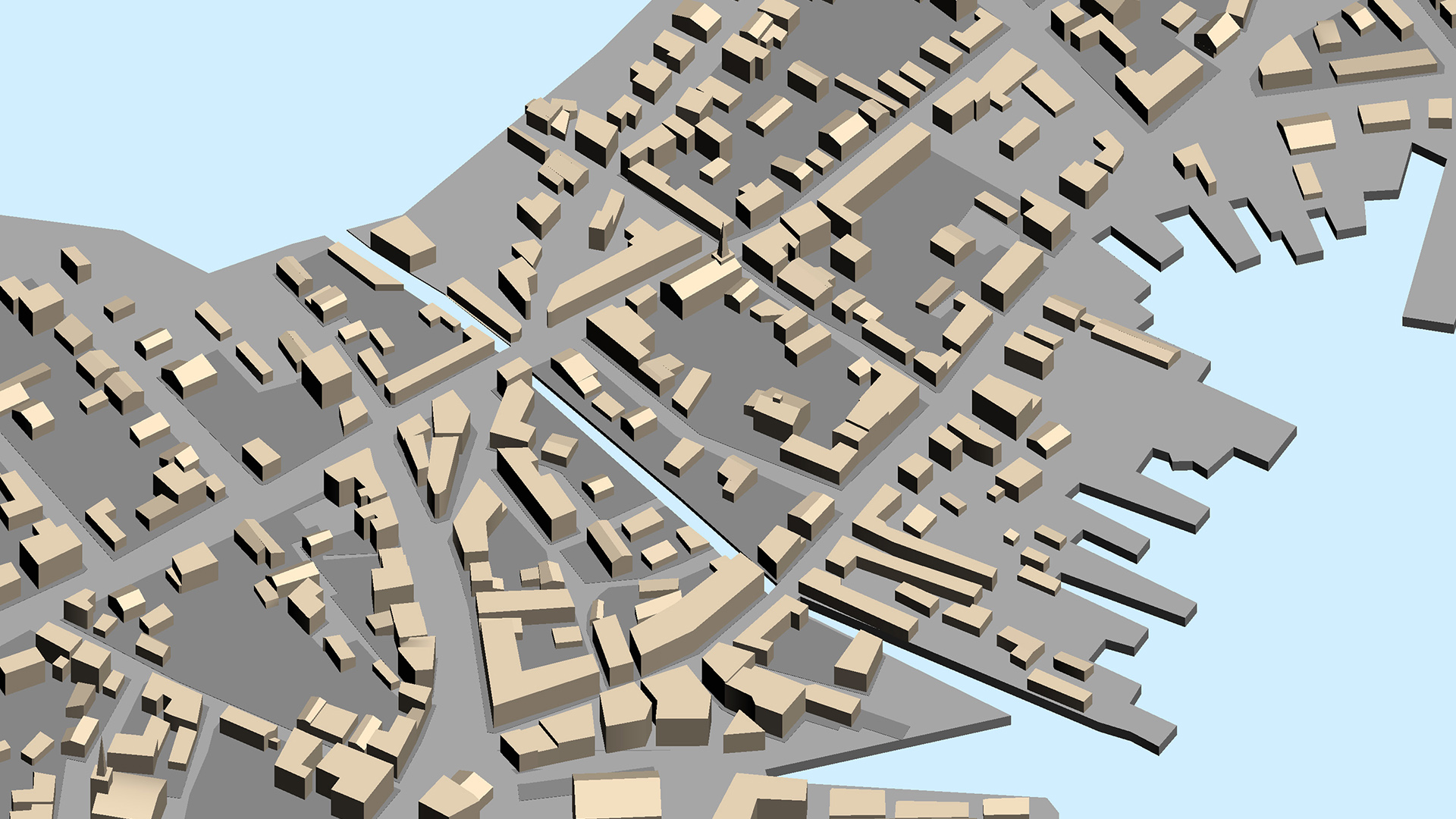
To help the community better understand what had been lost, we digitally reconstructed the North End’s history, which enabled residents to visually recall what their neighborhood looked like before the highway was built in the 1950s. Also, multiple historic layers were digitally “excavated” and reconstructed, giving community members a better understanding of how their community evolved and what “traces” of past developments still resonated in Boston’s new fabric. The analysis revealed that Hanover and Salem’s streets had always played an essential role in the North End’s structure. Similarly, the size and grain of the neighborhood’s buildings and spaces served as a metric for measuring the scale of future proposals by the Commonwealth.
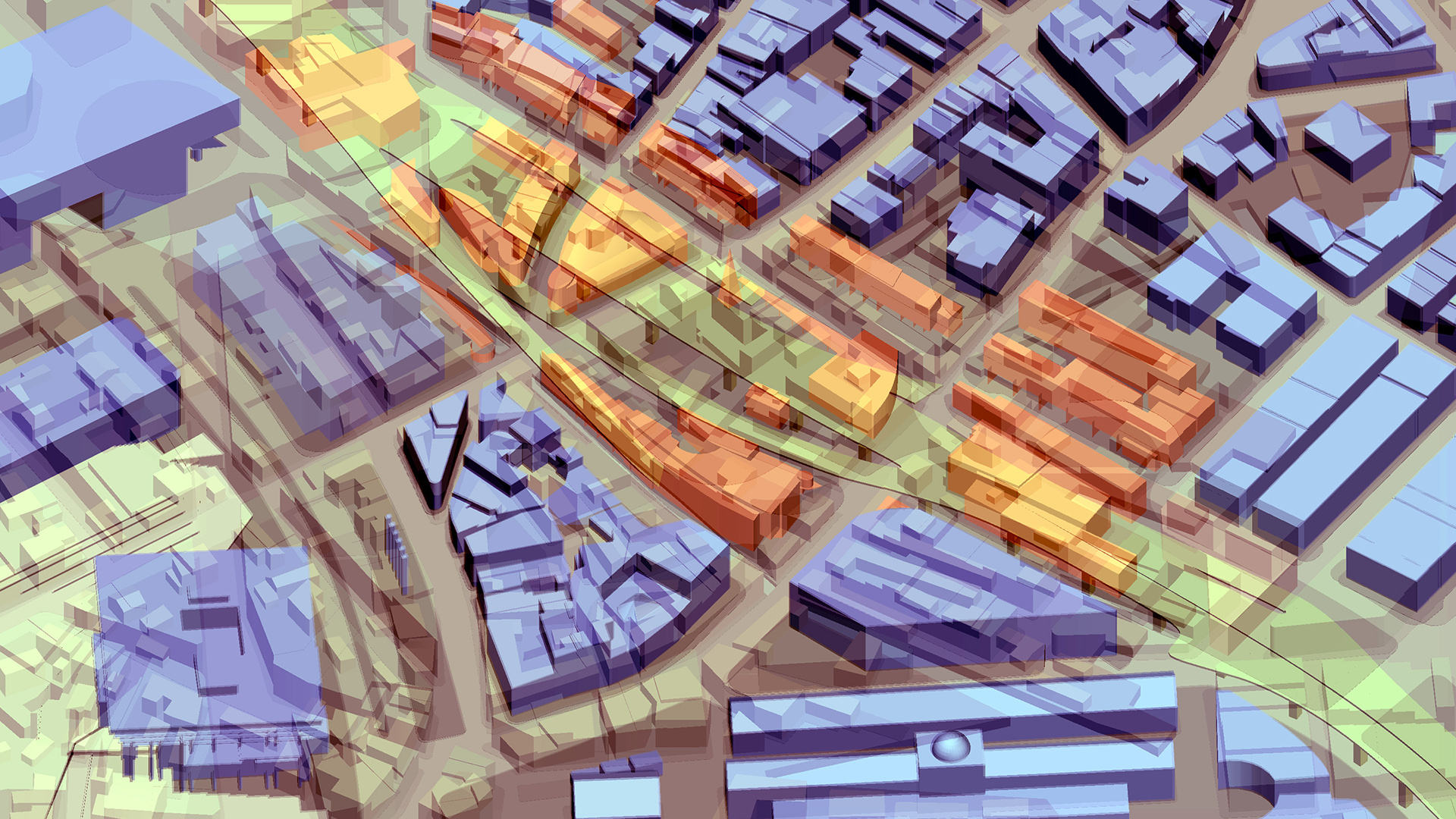
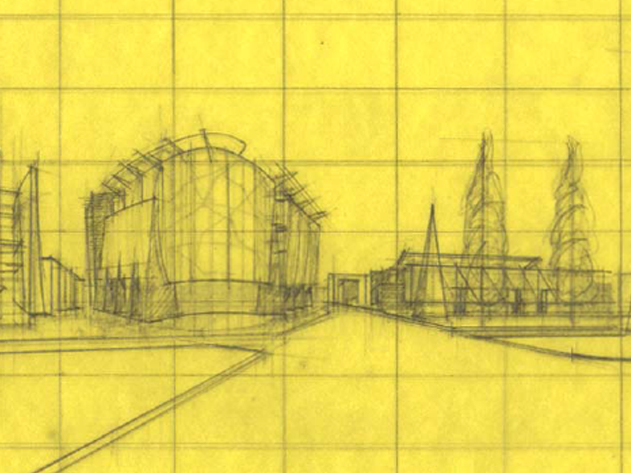
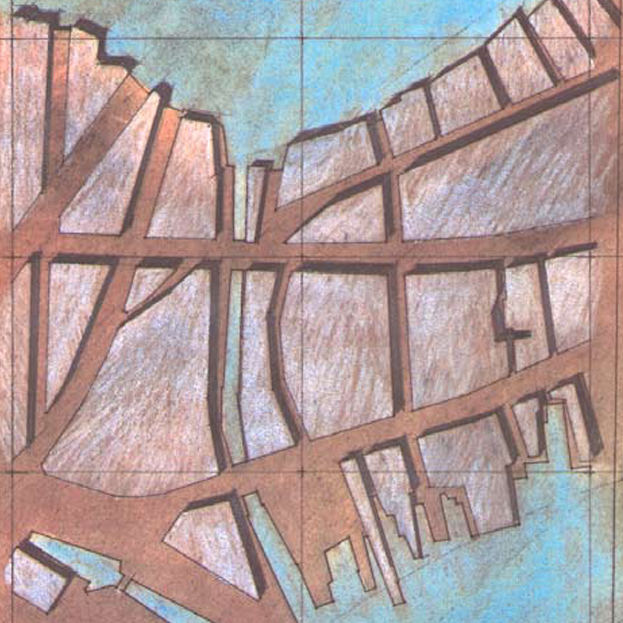
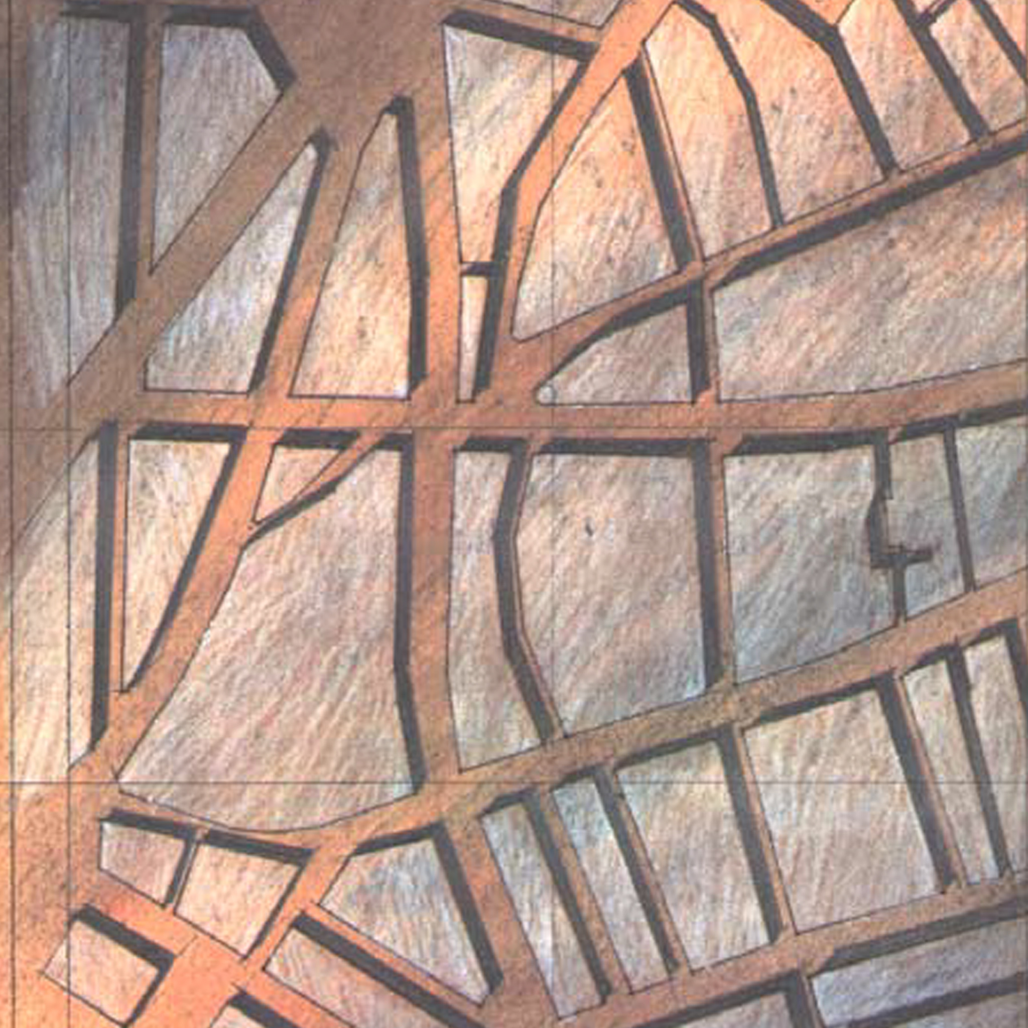
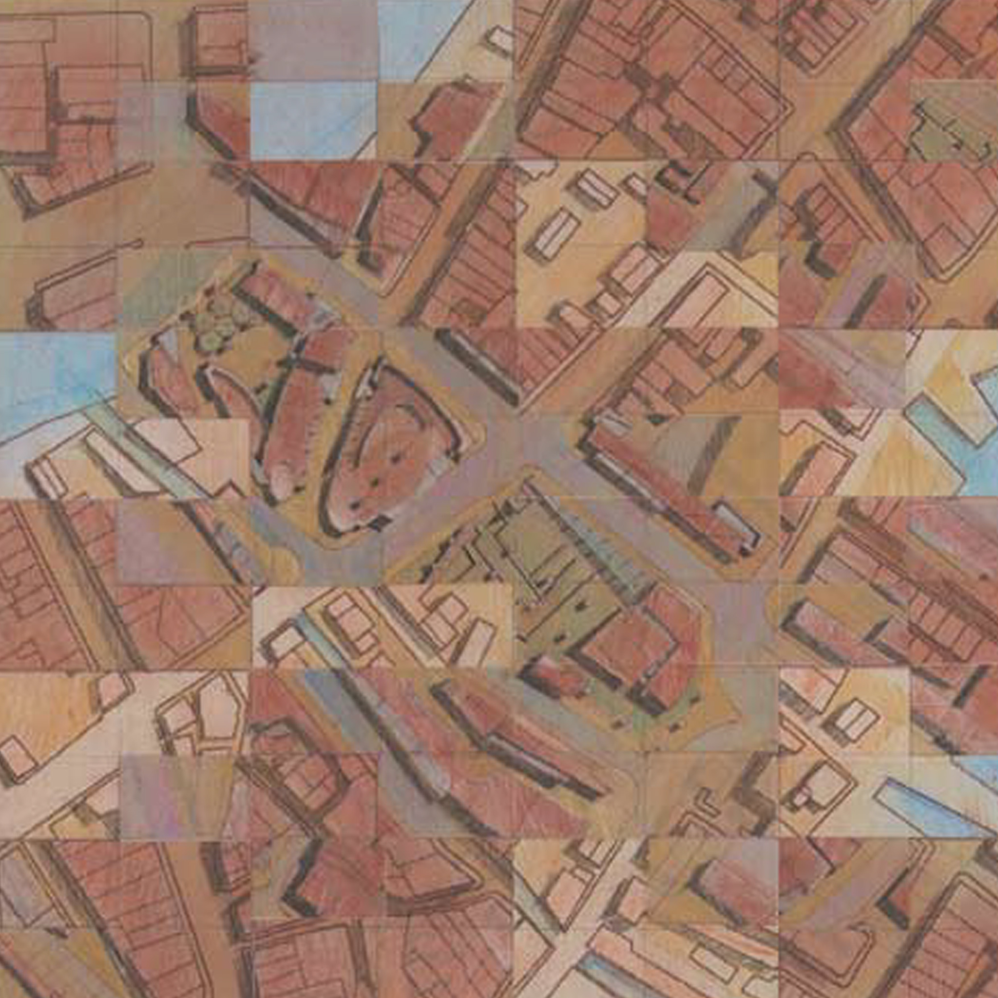
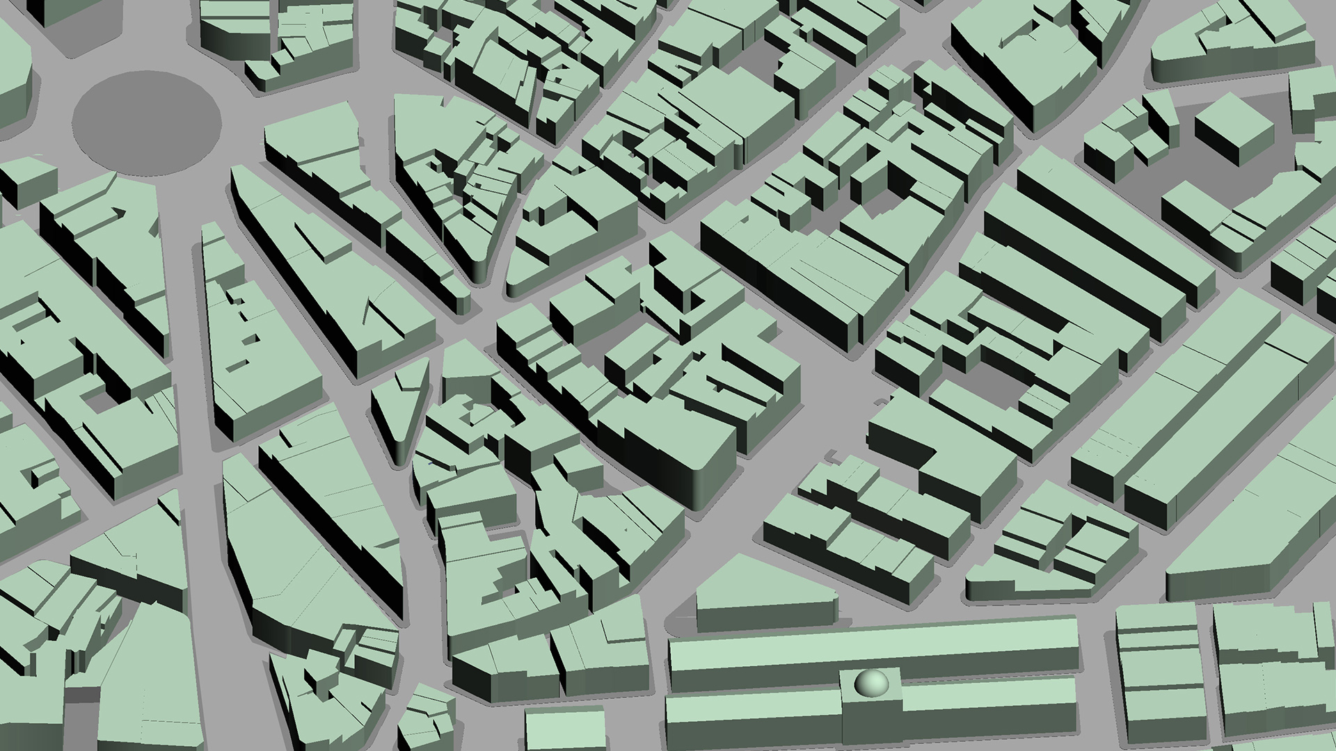
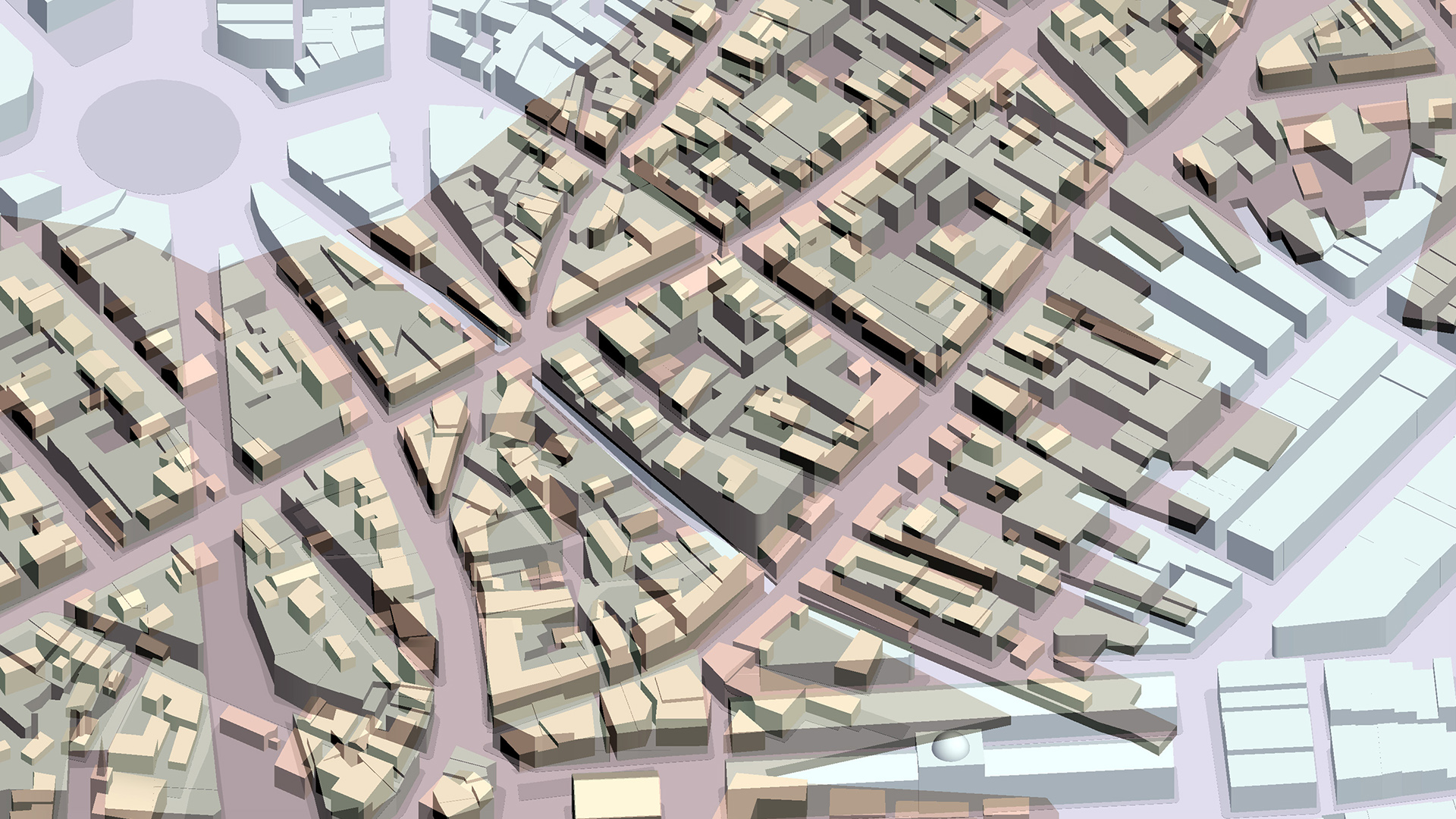
In response to the Commonwealth’s review process, the community group proposed a series of composite digital images that suggested programmatic and design opportunities. By overlaying all historic layers and building/spatial volumes over one another, a historic collage emerged. This digital collage was then edited through selective acts of erasure and overlaying them with new design themes, programs, and forms, often yielding evocative images of what might become of the site in the future. This futuristic projection evolved from the historic tapestry generated through our research and was thereby more deeply connected to the past. These proposals were able to project new design opportunities reflecting contemporary needs.
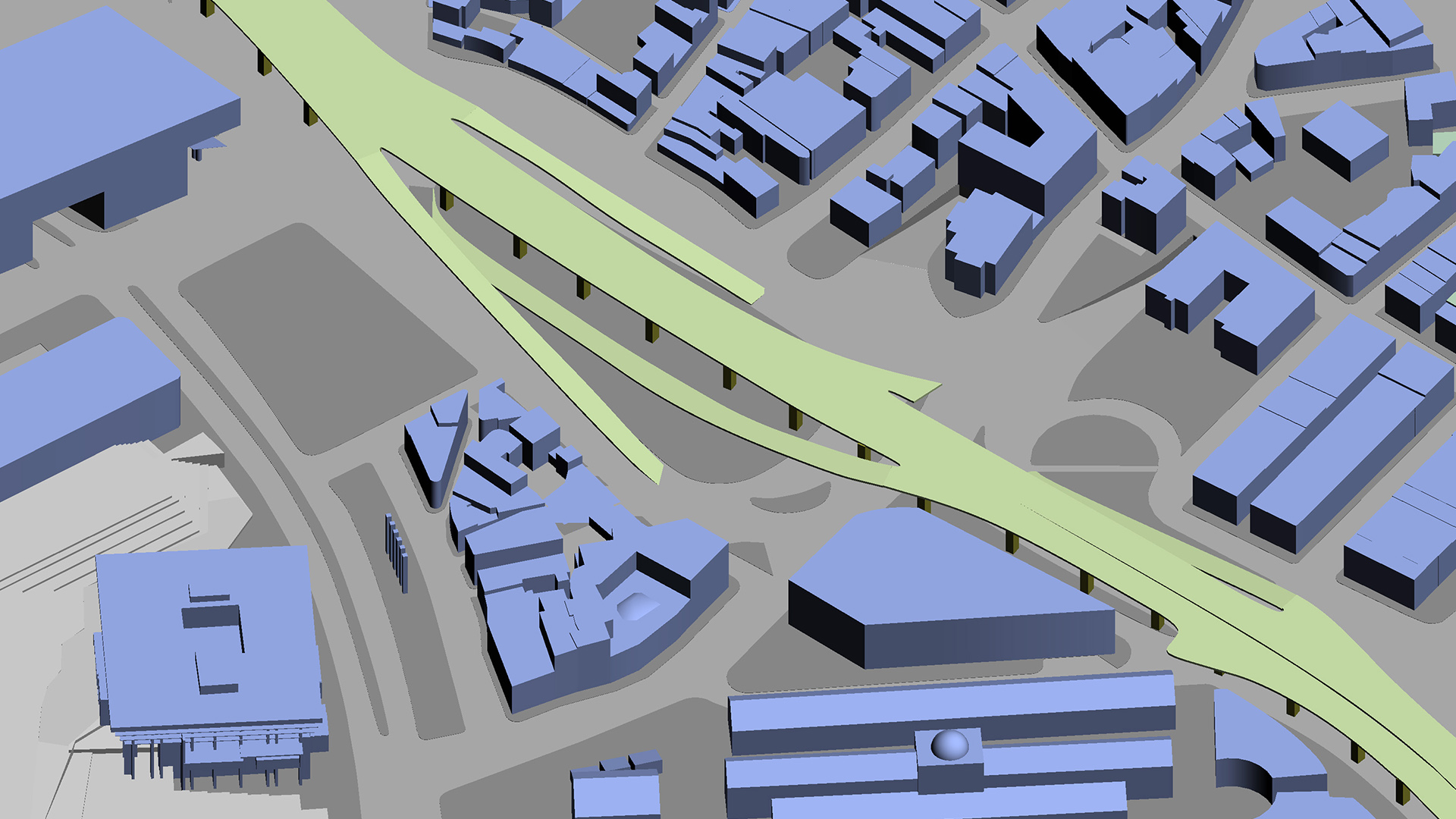
Proposals teased out of the drawings included making Cross Street the new “facade” of the North End by strengthening the street’s edges and the future park across from the North End with pergolas, an allee of trees, and pedestrian-rich amenities (seating, etc.). Finally, proposals for the park itself, and major paths and roads cutting through it, were advanced so that they resonated with the underlying order of the site and its history.
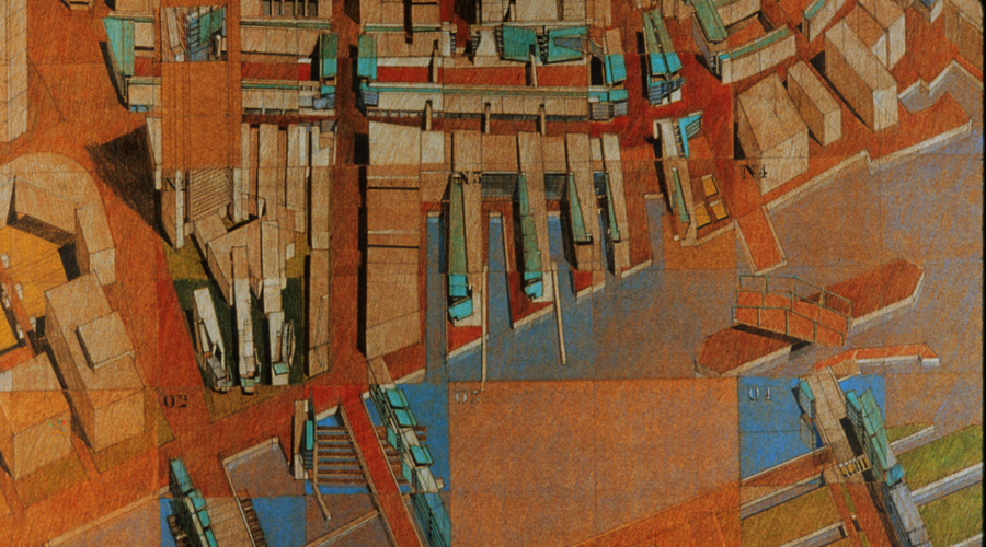
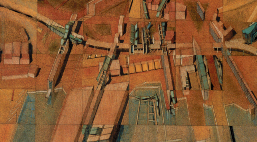
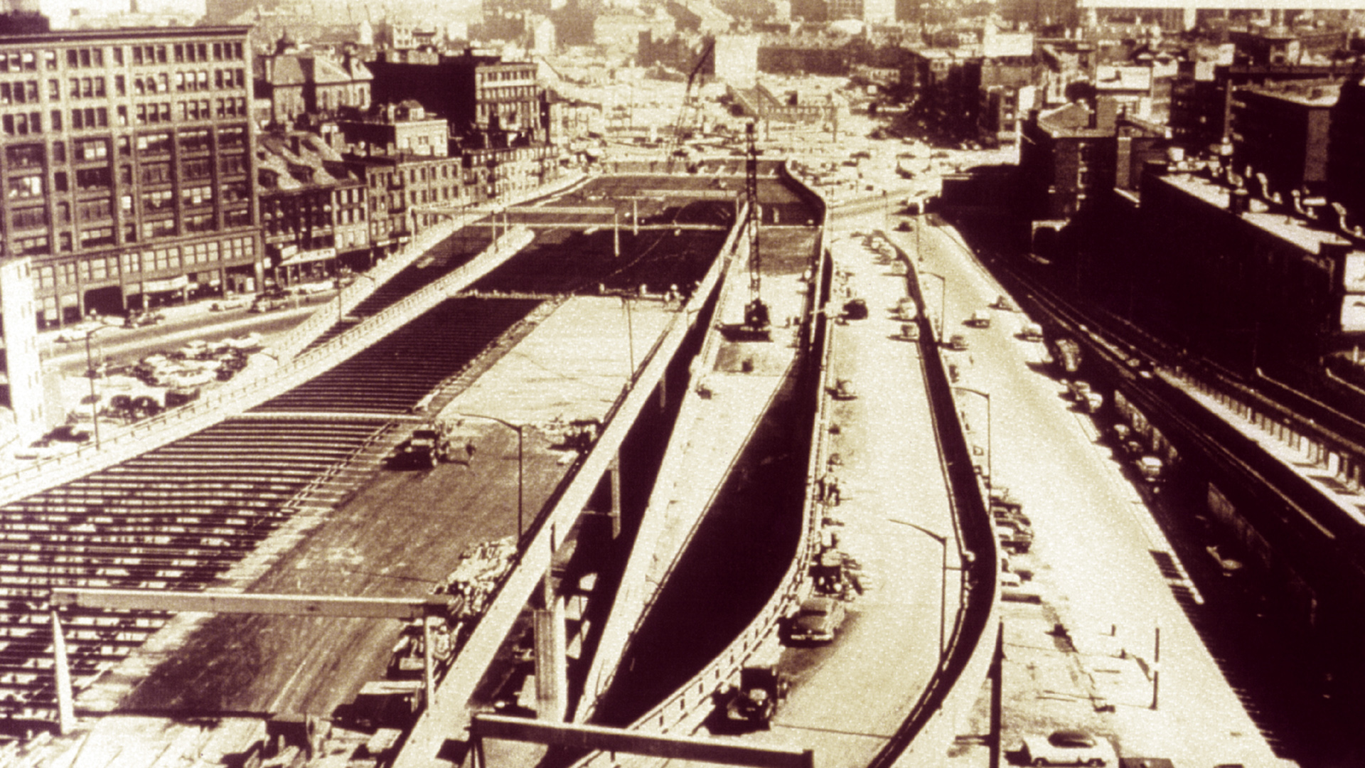
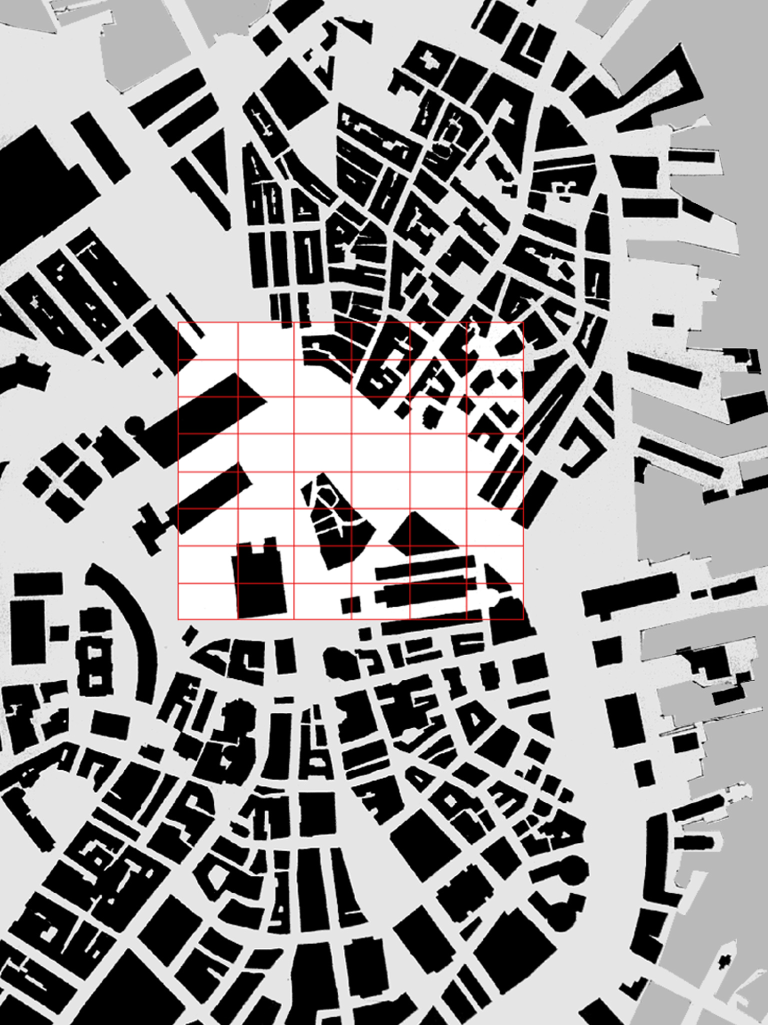
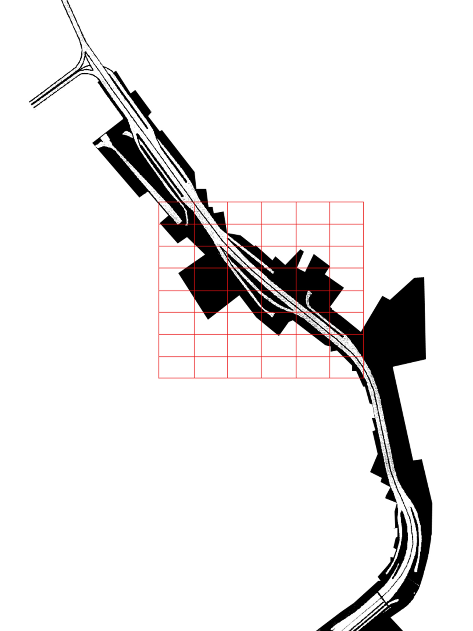
To help the community better understand what had been lost, we digitally reconstructed the North End’s history, which enabled residents to visually recall what their neighborhood looked like before the highway was built in the 1950s.
1800
1900
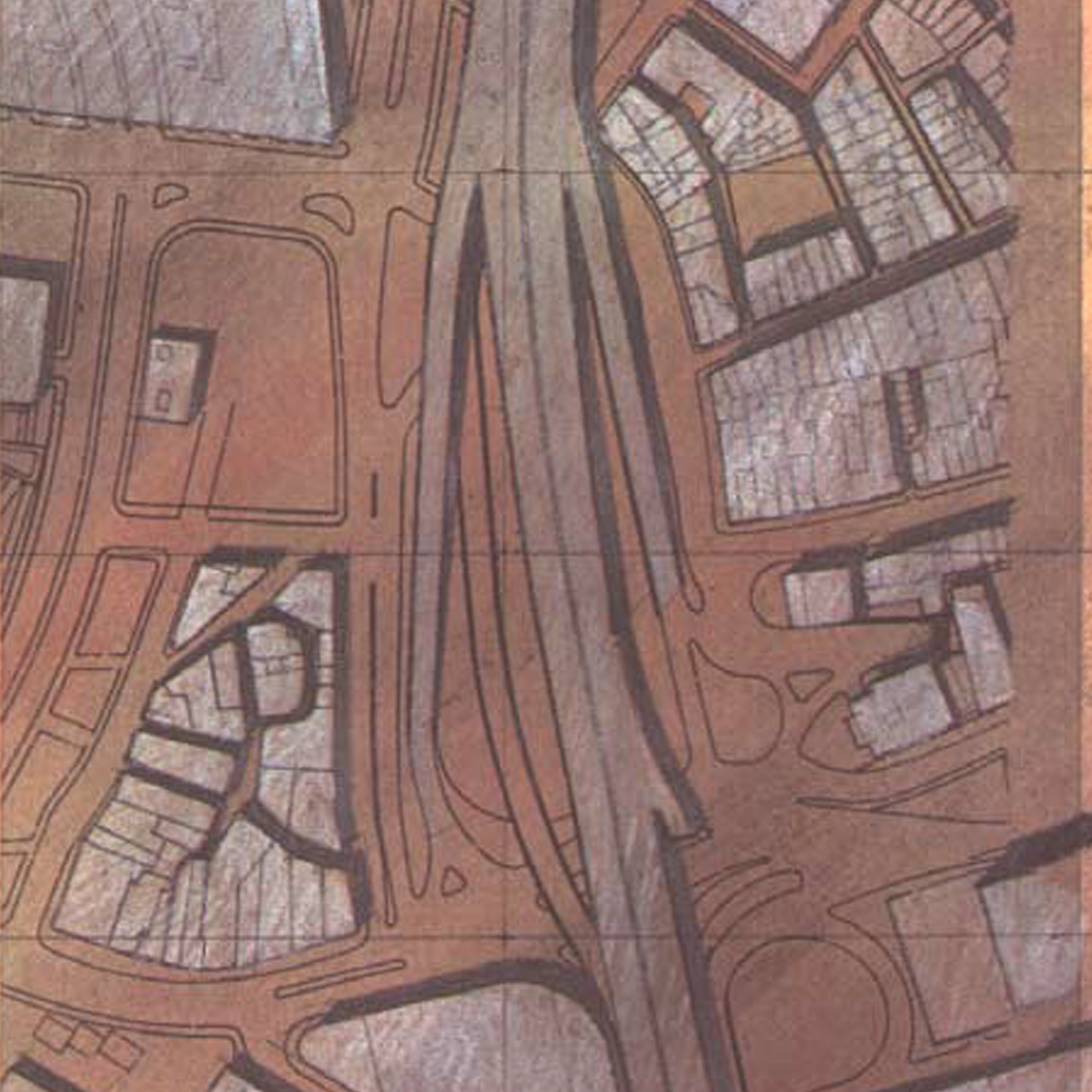
1997
1800 + 1900
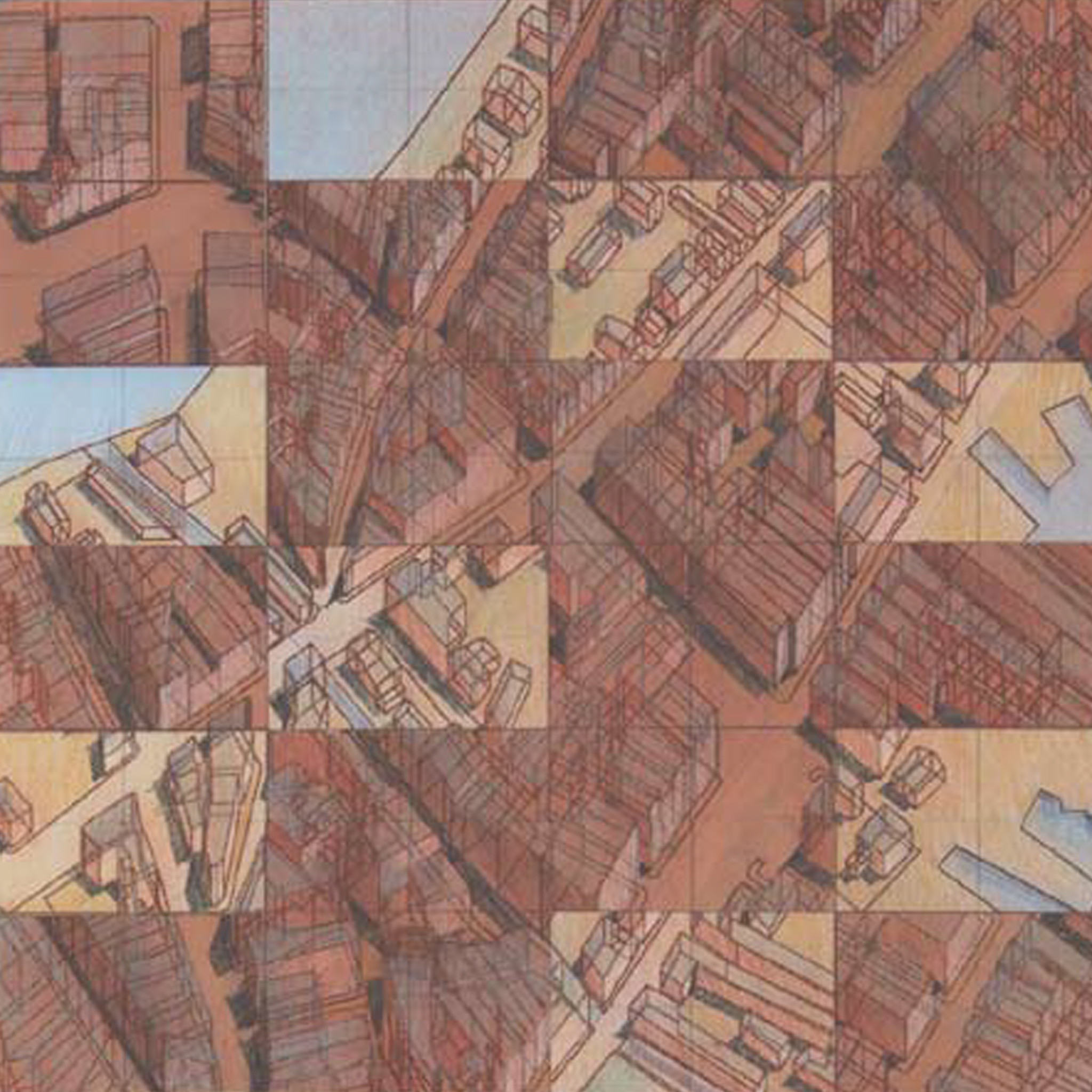
1800 + 1900 Axon
1800 + 1900 + 1997
1800
1900
1997
1800 + 1900
1900 + 1997

1800 + 1900 + 1997