Synopsis: The I-90 turnpike cuts through Boston’s Allston-Brighton neighborhood, usurping a large swath of land abutting the Charles River, Boston University and Harvard University in a way that separates communities and landscapes. This proposed condensation of the highway would yield large parcels of new land and air rights for development into a thriving new riverfront community and greenspace.
Detailed Description: In the 1990s, Boston underwent a massive urban transformation when the $15 billion Central Artery project submerged and reconstructed an elevated highway. This yielded 17 acres of new urban parcels for public space and parks, which stitched the city’s urban fabric back together.
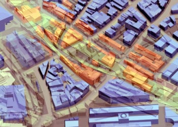
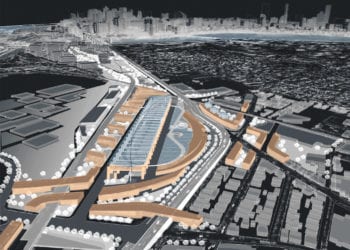
Today, a similarly scaled project enables Boston to correct another urban design mistake in a way that adds another array of public spaces and landscapes: a massive reconfiguration of an I-90 highway and turnpike interchange that occupies a wide swath of underutilized yet strategically located land in Allston, Brighton and Cambridge, separating these neighborhoods from one another. Running parallel to Storrow Drive, the interchange also limits access to the Charles River.
Community groups have worked with the Commonwealth in a design review process for years, voicing their desire to make sure this project makes the most of the new land and air-rights sites that will open up for development once the highway reconfiguration is completed.
PLA is part of the Allston Landing Design Team (ALDT), headed by John Shields FAIA, Richard Burke FASLA, and Frank Costantino FAIA. This ad hoc group has worked with local coalitions, leading stakeholders, and planning/urban design experts to develop a set of guidelines and principles for reconfiguring the highway.
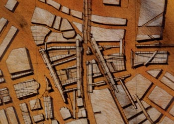
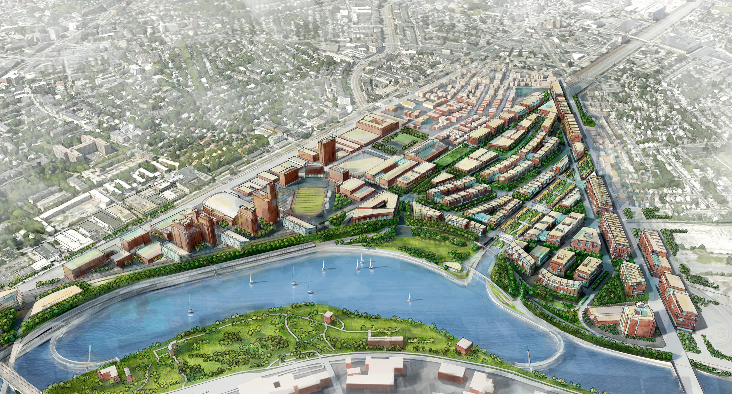
Central to the proposal is reconstituting an estuary through the site that feeds into the Charles River. A linear parkway would run along this new estuary, creating a new armature for future urban development. In addition, the parkland running along the Charles River would be increased by redesigning Storrow Drive and pushing back urban development along the new riverfront parkway.
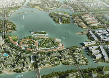
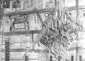
The plan for this development borrows from Boston’s historic Bulfinch Triangle neighborhood designed by Charles Bulfinch, America’s first architect. The triangularly shaped land generated by I-90’s new configuration is parceled into new blocks, creating a distinctive new neighborhood.
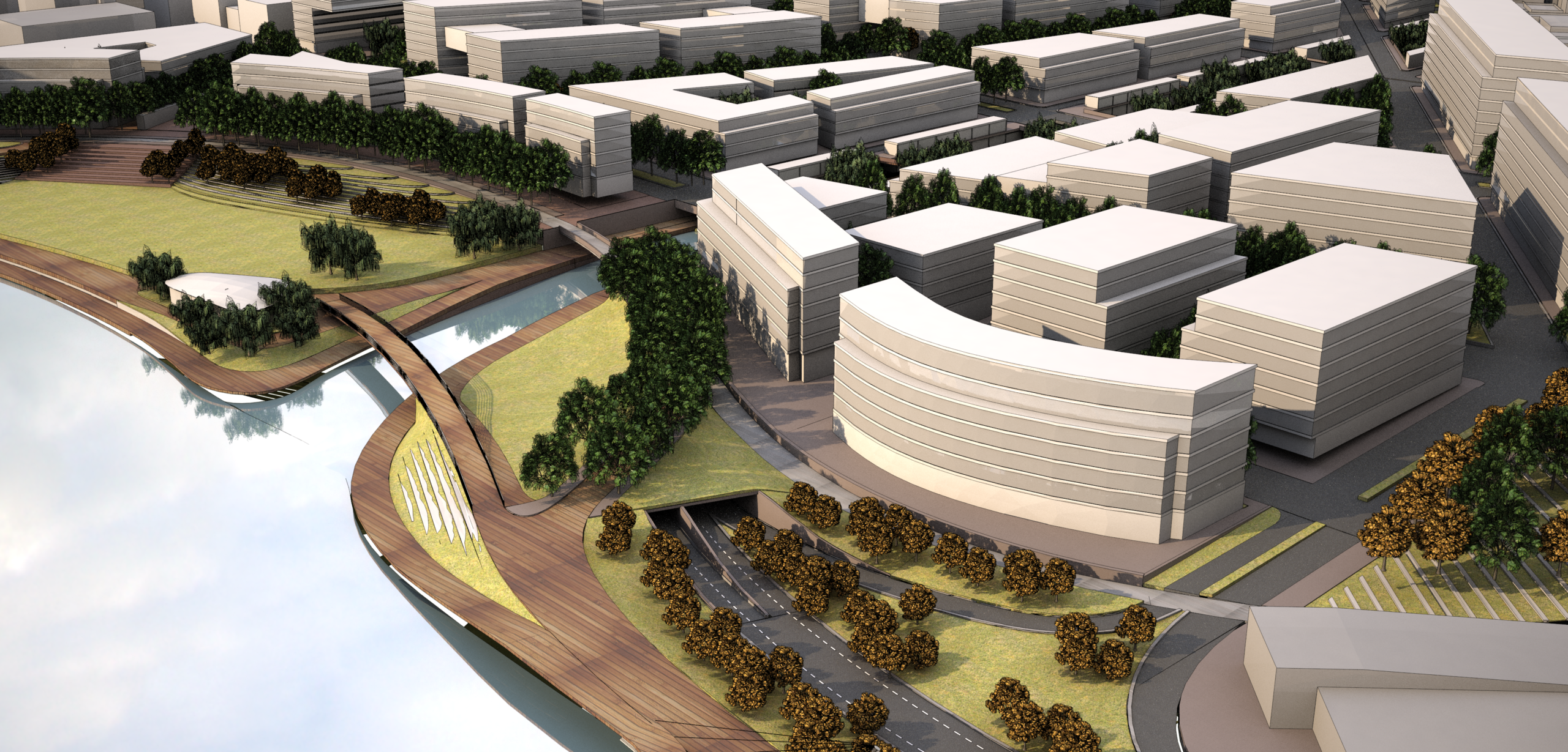
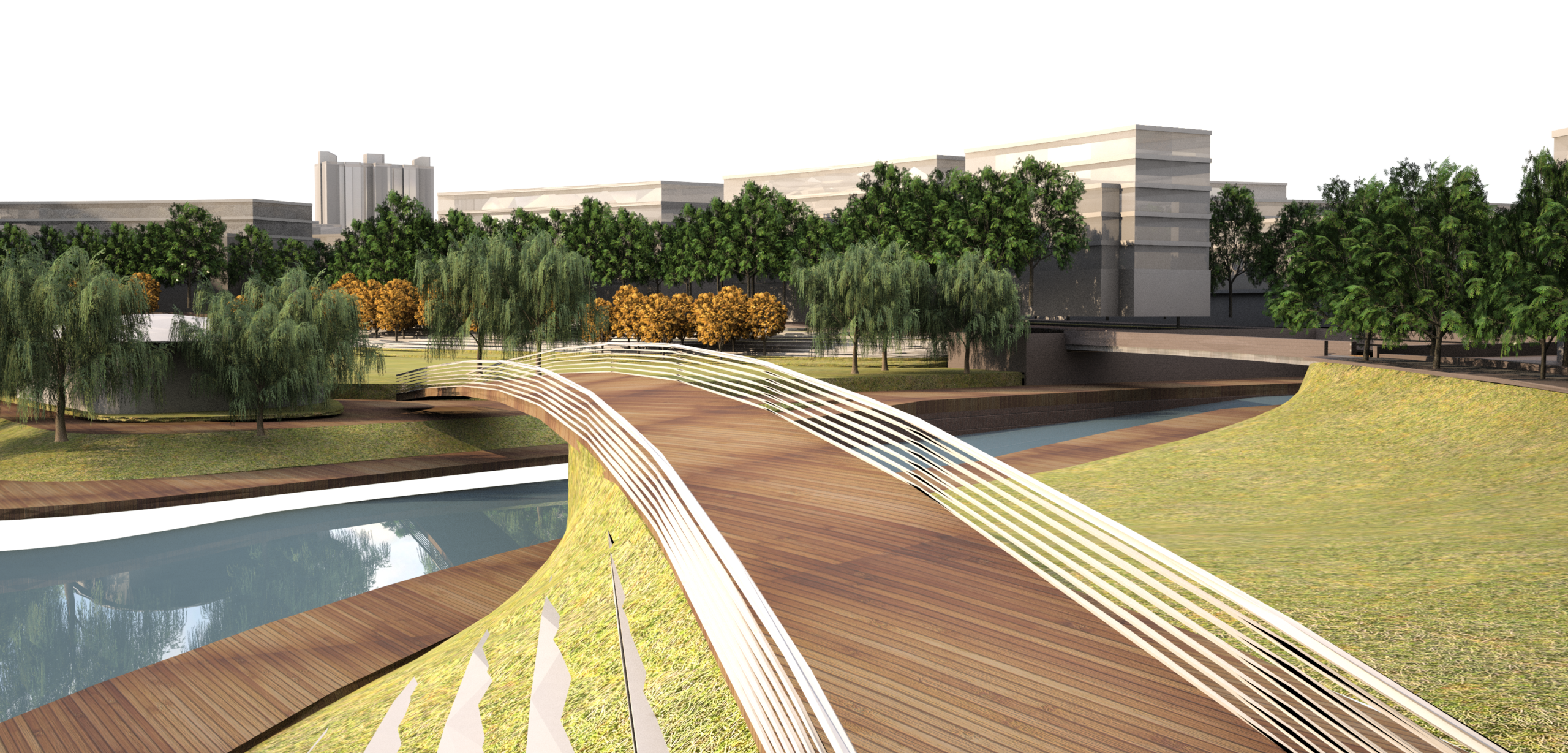
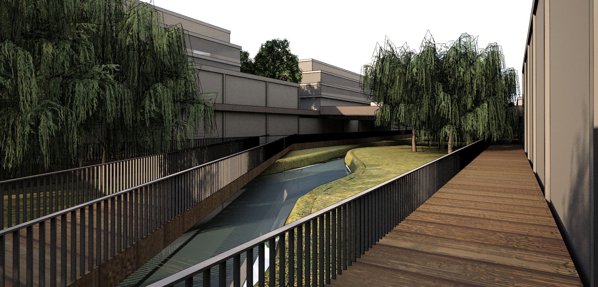
Central to the proposal is reconstituting an estuary through the site that feeds into the Charles River.
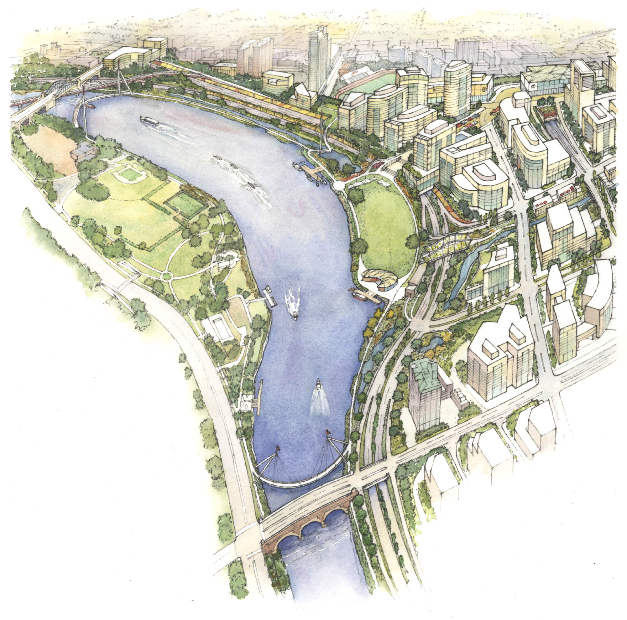
Illustration by Frank Costantino FAIA.